Origins

That familiar marker – a curvaceous double C on green and blue – boldly pointed the way once again. Forward along a pleasing meander into the bosom of a small gully. Emerging on the other side, inviting you into a stretch of rambling forest. In glowing afternoon sunlight, yellowing green under a pastel blue sky. A passing resemblance to that familiar marker, boldly pointing the way once again.
There was something even more familiar about this marker and it suddenly struck me: this was my origin. My inspiration. Subliminally or otherwise, this was where it all began. Not in physical form but in my head and heart. This was where – in those early peculiarly novel days of coronavirus when practically everyone was out walking – the Canberra Centenary Trail stuck up its hand and said, here you are.
And here I am once again, now nearing the end. A lot has happened in between yet in other ways nothing has changed. The virus is still here and in places making a strident comeback. What was then a mildly entertaining game of keep your distance and scrub your hands and fight for bog roll is now a reminder of unyielding persistence and unfathomable transformation. What was a wonderful seeping into a mild, golden autumn is now an immersion in winter and – eagerly – the hopeful signs of spring. What was a word count of zero is now over thirty thousand. It may be an uneventful trail in the scheme of things but there is plenty still to say.
It is almost certain that around now I would be confidently saying southwest is best. But in a different southwest in a different land in a different time. Can I still make such pronouncements with the trail as my muse? Certainly today, within that passing resemblance of that familiar marker, it presents a good case. But of the storm drains and fences and power pylons and scrub required to reach this point, such platitudes are diminished.
Southwest turns out much like the rest. A conglomeration of everything that is Canberra. Mostly good and almost always lucky. On the cusp of ancient, untrammelled wilds without ever cutting the apron strings to suburban comfort:
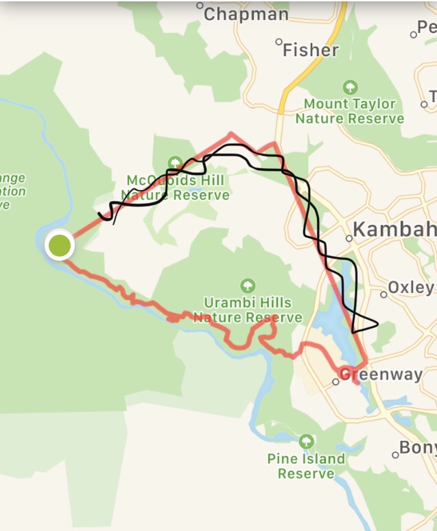
- Day 16: National Rock Collection to WVAC
- Day 17: WVAC to Cooleman Ridge
- Day 18: Cooleman Ridge to Kambah Pool
- Day 19: Kambah Pool to Lake Tuggeranong
Now at a figurative Land’s End beside the becalmed waters of Lake Tuggeranong that familiar marker points east. East to the end.
Tuesday July 7: Shooting

I’m not entirely sure what possessed me to take up archery. Perhaps it was the glamour and prestige destined to propel me to uber-cool status. Or, more likely, a desire for a new ‘project’ where I could add another string to my bow. Something to aim for. Beyond that, I remember thinking it was an opportunity to meet some new people and do something different. And befitting as a sporting activity that is age-appropriate.
I think I first tried archery just before turning 40. If buying a potentially lethal weapon and occasionally fletching arrows on a Friday night constitutes a mid-life crisis so be it. Some people go for the hot red Ferrari; I just received various contraptions whose purpose could be misconstrued delivered to me by a company called Alternative Services. I will never forget collecting that package from the depot.
Today, the contraptions occasionally accompany me down to Weston Valley Archery Club and sometimes miraculously coordinate to find gold. After several years of shooting up here I was totally unaware that the Centenary Trail meandered nearby. Until, of course, recently. When another target came to possess my mind.
I felt there was a nice touch of something or other that I cannot put my finger on in making the archery club the end point of my walk today. From here it was a pretty easy ride to the start, following the cycle path along the Molongo River as it joins Lake Burley Griffin at Scrivener Dam. The challenge was to nail the timing: heading out by bike late enough in the morning for it to be not entirely perishing and before the wind strengthens. Dallying about getting a coffee beforehand the southerly breeze proved strongest while on my bike.
Still, at least that direction provided a little tailwind at times, delivering me back to the Centenary Trail at the very exciting National Rock Garden. I only partly jest for they are impressive rocks showcasing different geological zones across Australia. The local Canberra Limestone seems very underwhelming among the smooth Hawkesbury Sandstone and the decorative and catchy Oorlano Metasomatite. For me, the Brockman Iron Formation stands out, extracted from the Pilbara in the northwest of Australia and reminding of adventures in rugged gorges and lofty escarpments. It was probably this rock that caused a puncture and led to salvation from a man far stronger than I.

Back in the present, my footsteps kissed the boring limestone of the western reaches of Lake Burley Griffin under another glorious winter sky. It seems preposterous but I believe this was the first time my footsteps had taken me along here – cycling proving the usual method of propulsion past this more remote section of the lake. It was no surprise, therefore, that I was the only walker today and the regular flow of cyclists appeared surprised to witness such a feat.
The good thing with walking is you take much more in, even if this means weaving on and off the path in a manner causing alarm to passing cyclists. Like wandering into a copse of beautiful gum trees meeting the lake’s edge, with views across the reeds and calm water to Government House. Or taking in another tunnel of cork oaks dappled by the sun. At Scrivener Dam – representing the western terminus of the lake – a previously unseen flight of steps led down to offer closer scrutiny of concrete and water levels.


The dam spills very occasionally into the Molonglo River, which then meanders to join the Murrumbidgee to our west. Given predominant climatic conditions of dust and dirt, a dam opening is quite the event, attracting eager sightseers in the adjoining car park. Even the lions across at the zoo tear themselves away from an antelope steak to gawp open-mouthed at the torrents of water crashing into the river. Meanwhile the giraffes nonchalantly peer over the edge, tailormade for such snooping.

There is of course no such drama today, just a very placid ribbon of water heading south, directing me to follow. Not long after the dam, the Centenary Trail farewells the main lake circuit and its frequent bicycles and instead follows the Molonglo towards Weston Creek. It’s quiet and pleasant and not really much else. Horsey bits and pieces are scattered around in a nearby field, with equestrian routes feeding down to the river. Across the other side, a pine plantation shields the eyes and the ears from the Tuggeranong Parkway.
While this sustains for a fair while, there is no escape from the parkway, the trail meeting an amalgam of concrete and electricity pylons as a busy bridge crosses high above the river. A discarded tyre adds that key ingredient to the scene, the point of detail and focus within an epic landscape. Once under the bridge, the landscape again subsides to a continuum of placid river and scrubby, tangled bush; not as pretty as a picture, but a picture nonetheless.

It is during these times that my mind naturally wanders to topics rich and rare. I cannot remember exactly what was going through my mind on this occasion, but it eventually came down to the eternal question: what’s for lunch? This used up a good deal of time as the repetitive backdrop progressed, full of equations involving bread conservation and salad expiry, financial expenditure and interrelationships between lunch and other impending meals. Given various configurations were circling through my brain I had largely missed the fact that the river had now moved further west, away from the trail. Instead, up a small rise the path progressed closer and closer to suburbia and, at its crown, McDonalds.
This is a fairly new McDonalds – constructed for the burgeoning population of Molonglo – and sits alongside a few other pitstop services. It’s close to the RSPCA and one sincerely hopes the two are not related. I tend to visit McDonalds sparingly, often in a desperation which usually peaks in the midst of summer with frozen one dollar sucrose hits. But seeing it there today after all those food thoughts going around my brain resembled something akin to fate.
There was one proviso: I didn’t want to spend anything like ten dollars on what would turn out to be a disappointing, regret-laden lunch. Surely, they have some dollar hamburgers or something right? Well, the best I could find was a $2.50 burger or some configuration allegedly involving chicken for three bucks. Was I really that desperate, when I could have a slice of bread and some wilting salad at home? I turned back out of the store with a tinge of pride at not succumbing, but not before a good fumble with the McCOVID touchscreen.
If, like many, I had grabbed a burger and then sat in my ute in the car park I would have been rewarded with a decent view. A largish pond has formed between here and the new developments of Molonglo, backed by the sprawling flanks of Mount Stromlo. The pond is undoubtedly another element of the water management network in Canberra as well as a feature in property development marketing. The pond filters into a brief canal that peters out right next to Weston Valley Archery Club. I do believe I may have inadvertently fired an arrow into that storm drain in the early days.

And so, like an arrow now even more intent on lunch I gathered quickly towards the blue of my car. Taking a brief glance at the archery field, checking out if the butts which were still untouched. I’ll get back there again soon, but other targets just keep getting in the way.

the numbers
Trail Section: National Rock Garden – Cotter Road
Trail length walked: 6.5km
Total length walked: 7.6km
Total steps: 9,000
Altitude gain: 59m
Thursday July 9: Biking

In normal circumstances it would be around this time of year that I would settle down on a cold Canberra evening, sometimes in bed, to absorb bright and sunny images of France. In this parallel universe village roads would be lined with people clapping and cheering and occasionally flailing around in mankinis. Farmer’s fields would have been transformed into an avant-garde arrangement of mechanical haystacks and polka dot cows. A clichéd sweep of golden sunflowers would rise towards an ostentatious chateau boasting an ornamental frog pond. The circus that is the Tour De France would be in town.
I would often approach the evening with enthusiasm at being transported thousands of miles away, eagerly awaiting the little foodie segment and checking out the route of the race on the map. Half an hour later, as a multi-coloured peloton bores its way towards a feeding station with 150 kilometres still to go, the shut eye and snoring would commence. This would be rudely awakened by animated exclamations of “IT’S A CRASH!” or a repetition of annoying adverts and annoying lamentations at how Richie Porte didn’t actually achieve as much as we hyped up again.
I would still see a fair amount of the race in total, aided by a big mug of tea and chocolatey treats. A special effort would be made for mountain-top denouements or muddy cobbles, as well as stages going through places I have known. There is nothing like seeing a Fromagerie you have been to in Beaufort – say – to conjure up memories of unbeatable Alpine baguettes with glorious views. Often these snippets prompt anticipation of another impending bite. But not this year.
A dreaded watchword of the TDF is “transitional stage” which finally brings me onto the Canberra Centenary Trail. There are clearly a few transitional stages on this walk, by which I mean largely dull and uneventful, lacking anything spectacular other than perhaps some newly introduced road furniture. There could always be A CRASH I suppose, but performance enhancing substances are far more likely to add some spice.

And thus I started out with a coffee on my way to a parking spot on the far side of Weston Creek. From here, looking out towards sunlit pasture and rugged mountains, the walk promises much. But this is what awaits on the following stage and first I need to get to this next start point by making it the end point of today. By which I need to get back to the start and what better way to do it than – of course – by bike. Allez.
As we inch towards spring, I am becoming increasingly wary of magpie hazards while cycling. On my way to Weston Valley Archery Club now I was all too cognisant of a swooping site previously causing me trouble. Not only do I remember but so too do the magpies and that is the problem. In fact not only do they remember but they tell all their friends and relatives and pass it on to their babies and – oh sod it – might as well inform the magpie larks and wattlebirds too: this guy is fair game. But thankfully not today.
From the archery club, the walk commenced alongside what might be generously termed Little Venice, in that there was an outlet from a pond channelled between some concrete that fed under an artistically adorned bridge. The convoluted looping of paths and slipways and a canal crossing used up a good hundred kilometres or so before proceeding west, towards the sunny slopes of Mount Stromlo.
The trail largely follows an open tract of land between two roads (Cotter Road and Dixon Drive) – far enough away from the bitumen to evoke countryside yet close enough to remind you that you are on the Canberra Centenary Trail after all. A few conifers shielding the road remind me of Christmas while some swampier areas have been repurposed into wetlands. This is Holder Wetlands and a sign helpfully reminds that this has been another friendly initiative of local government. Just one change, one development among many: over Cotter Road, the land-clearing and closely-packed erection of homes and apartments continues apace.

An almost imperceptible rise takes place and exposed to the northerly sun under breathless skies I start to feel warm. Hot even. It’s shaping into the kind of winter day where you can laugh in the face of winter and remove your fleece. Until it comes back to bite you in the feet in the evening. And despite the toasty ambience, there are no sparkling sunflowers or golden haystacks, a cluster of bare trees signalling the season we remain embedded within. Yet I can take this winter more than a French one.
It was 2008 when I returned to Europe for Christmas and travelled over to the French side of Geneva. At first it felt like a nostalgic movie, exiting a frigid old railway station into the night air as gallic nonchalance crossed the road to the bar-tabac. Frozen leftovers of snow clumped upon walls and gathered in gutters, defying the piercing wind which was penetrating my useless jacket. The next morning proved dreamier still, gallivanting into sunny snowfields up in the foothills of the Alps. But the remainder of my time, under stubborn grey lake cloud, proved arduous and – by the end of the trip – I was over it. Thank goodness for tartiflette and vin rouge.
Perhaps if Mount Stromlo had a cute lodge selling tartiflette and vin rouge this walk today would have been a standout rather than ‘transitional’. It is undeniable that more lunch stops on this trail would definitely be a good thing. Perhaps Alpine Chalet style with additional ice cream options. My mind had turned to lunch (again) with a message from a friend proposing such an event. This caused a minor fluster as I wasn’t sure whether she meant today or tomorrow. And being very keen on lunch, I suddenly got a march on.
As it turned out the plan was for lunch tomorrow, but I didn’t know that while scrambling to find the way to a trail marker in Mount Stromlo. This is the end / start point of Day 5 / Day 6 in the official Centenary Trail guide online. As a little extension off the big loop, its sole purpose seems to be to expose you to Mount Stromlo Forest Park which is all about various mountain biking rad moves and awesome joint dislocations. Maybe, just maybe, I’ll give one of the gentle trails a go one day.
It’s probably a shame that the Centenary Trail doesn’t go further to take in the summit of Mount Stromlo, though given I was still thinking of getting a move on for lunch I felt somewhat relieved. Atop Mount Stromlo are a series of telescopes and associated nerd-filled buildings looking out to the Brindabellas and far, far beyond. Also standing on the hill are the ruined walls of a telescope destroyed in the 2003 Canberra bushfires. The fires killed four people and destroyed or severely damaged nearly 500 homes, many of them in the suburbs I fringe today. A memorial sits in the bush and I stumble upon this now. Bricks filled with messages hint at the devastation, the pandemonium, the loss.

Crossing Cotter Road, the trail heads towards Narrabundah Hill which is confusingly not anywhere near the Canberra suburb of Narrabundah. I used to live in Narrabundah and one of the more memorable things about it was the pronunciation provided by the automated taxi booking system when ringing for a cab. I cannot even begin to try to convey this in words. One other thing I remember about Narrabundah is watching the Tour De France on TV there for the first time – all so I could see again the streets of Annemasse and the drag up the valley road to Taninges.

Narrabundah Hill is scattered with plantation forest, eucalyptus trees giving way to pines at various points. I know this because I have been up to the top and down the other side, something that would be entirely possible again today if the Centenary Trail deigned to take a scenic route. There is also an equestrian track running along its bottom, but even that appears to be out of bounds for our beloved CCT. Instead, following the perimeter fence outside the reserve, the trail keeps within touching distance of a Eucumbene Drive kind of suburbia.

There are still some nice views looking back towards Canberra through the power lines and over tin roofs. Yet these are eclipsed when the hill subsides, and the western aspect opens up. Pleasant grasslands gently spill down into the valley of the Murrumbidgee. The ridges and folds of the mountains loom closer, dramatically rising up on the other side. Horses chew and parrots chirp in this gleefully warm sun. Squint and you could just be in the French countryside, entering the valleys leading towards the Pyrenees. Ready for the next stage. Transitioned.

the numbers
Trail Section: Cotter Road – Cooleman Ridge North
Trail length walked: 8.0km
Total length walked: 8.5km
Total steps: 9,750
Altitude gain: 127m
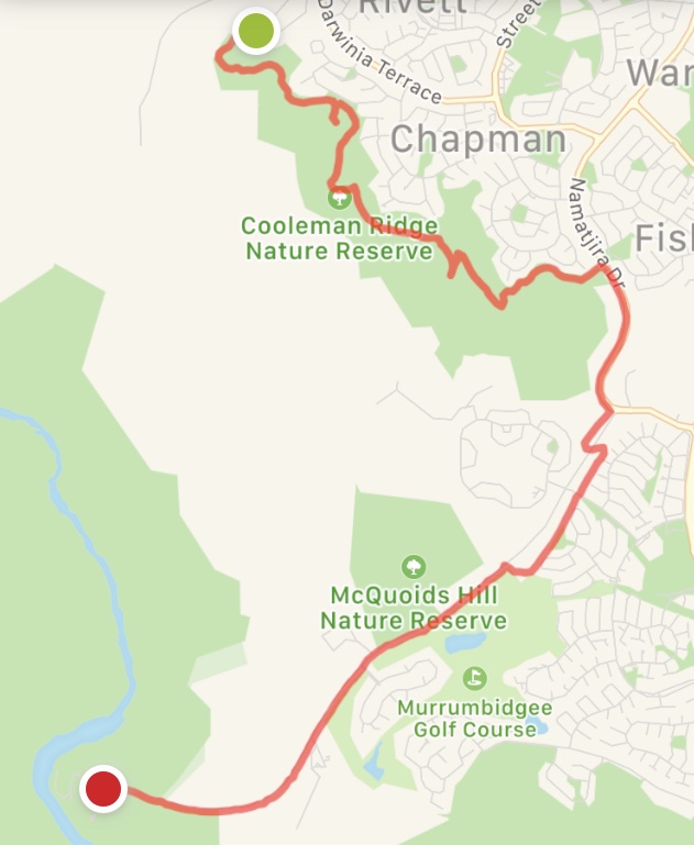
Saturday July 18: Fencing
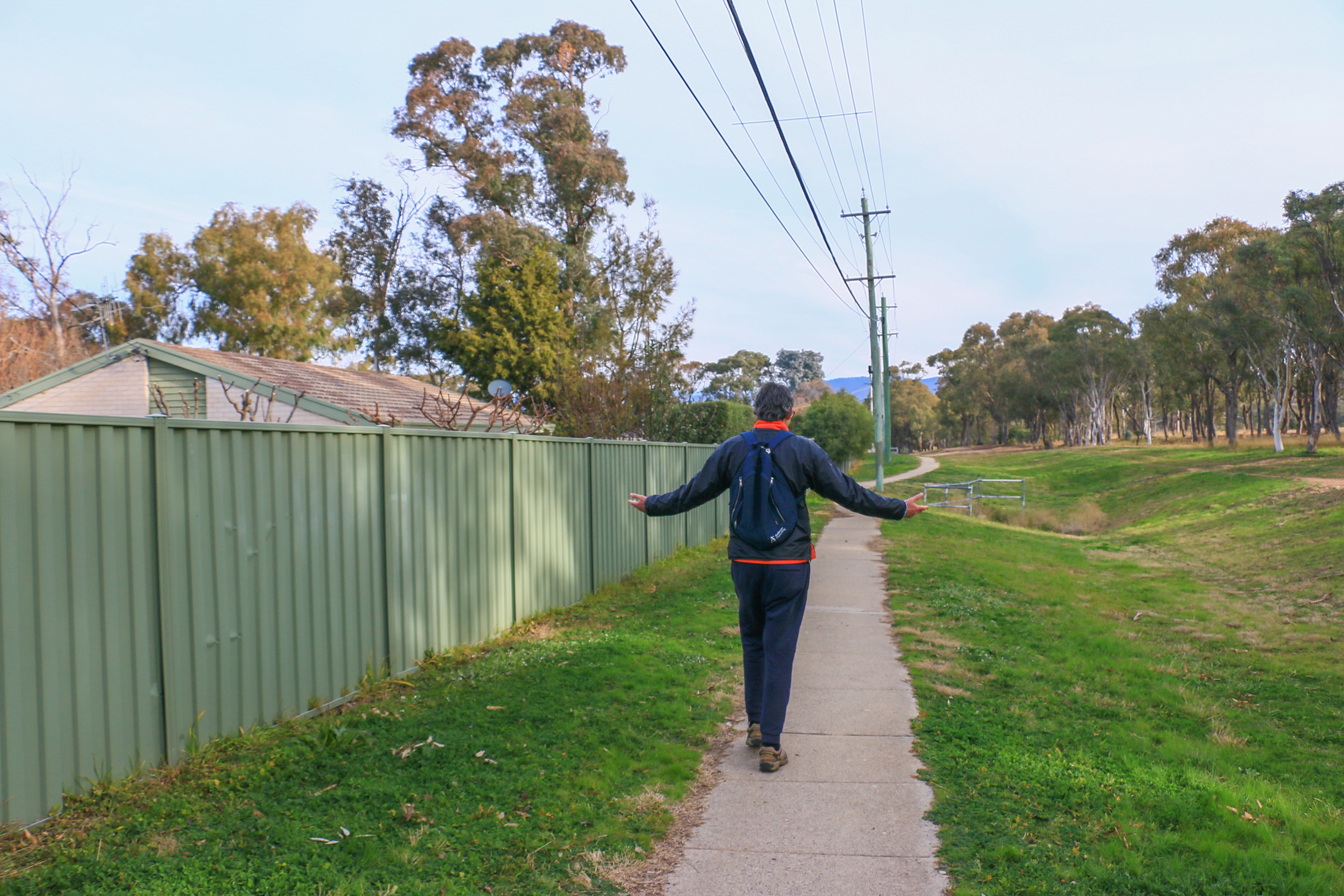
Something the Canberra Centenary Trail excels at is taking you on a tour of the capital’s fences. Along its course, many a track sits at the foot of a hilly reserve, following the boundary where the bush meets the backyard. It started out this way on Isaacs Ridge and continues in generous doses throughout. Often the paths are slightly elevated, so you can have a good snoop into people’s gardens and their generous open plan views. The kind of views you would be getting if these expensive homes weren’t in the way.
Today, following the western extremity of Chapman in Weston Creek, one place boasts a tennis court and swimming pool. Another house somehow resembles the water wheel of a paddle steamer. In more down-to-earth Kambah, a sturdy Colourbond fence protects a home-made adventure playground. Pergolas and patios suggest gatherings for dodgy sausages and caustic chardonnay.
The trail yo-yos between these inward-looking backyard revelations and the outward-looking panorama of open country. The leg today is archetypal in this regard, encompassing Cooleman Ridge Nature Reserve before heading down towards Kambah Pool on the Murrumbidgee. Starting at the northern end of Cooleman Ridge, the outlook is immediately outward. And wonderful, despite a tinge of smoke haze in the air. Back in late January this was a vantage point from which to catch glimpses of flame and plumes of ash, while a large water bomber and spotter planes ferried back and forth over the mountains. The scent of smoke today is an acrid reminder of those frantic times. Mercifully it emanates from a hazard reduction burn across the border.
After endless deep blue sky winter days that you again take for granted, the smoke haze comes as something of an affront. With the passing of time and the predominance of COVID, it seems a long time ago that such days were practically the norm. When that first front of smoke billowing in from the North Black Range Fire near Braidwood emerged at the end of November it was a curious novelty, a spectacle even. Then it came again, and again and again. From the coastal ranges in the east. From the plains down south. From the mountains in the west. Only a hot north-westerly would propel smoke-free air. Instead delivering dust.
The first day of 2020 really felt like a portent which hindsight only serves to strengthen. Waking early I drove to the lake, which was indecipherable from the sky. A white-grey shroud formed in every direction you turned, as if in some warped migraine-inducing dream. The land seeming to disappear off the very edge of the known universe into nothingness, any trees quickly dissolving away. On one hand it was ethereal and astonishing. On the other it was sickening. The silence haunting.
Towards the end of January, just as we thought things were getting better, with rains quelling some of the fires on the coast, a new plume of smoke shot up from the horizon. I remember it vividly, driving back from a friends’ place: this smoke was not in a direction I was anticipating. Before COVIDSafe, FiresNearMe was the app of choice and this confirmed a new ignition in the Orroral Valley of Namadgi National Park, within the ACT.
For a few days it spread and threatened and spilled over the border to destroy homes at Bumbalong. I remember seeing the flames from Red Hill and again from Oakey Hill and that thick plume of smoke rising up over Mount Tennant from Farrer Ridge. It was indeed a spectacle – for a Brit from the sodden southwest there was something gripping about it all. I felt guiltily like a bit of a rubbernecker, transfixed by calamity. But I was clearly not the only one. We were – we are – living through history after all.
A week later gentler conditions had subdued most of the fire. There were still some wisps of smoke rising up behind Tidbinbilla when I found myself gawping again, this time from Cooleman Ridge. I hadn’t been to Cooleman Ridge for quite a while and had forgotten how lovely it could be. Even with smoke on the horizon, the views down over the Murrumbidgee Valley and across the ranges speak of a landscape far removed from the city sprawling on the other side of the hill. I was inspired to go back again in March, before our next crisis, and never had I seen such a verdant outlook in Canberra following salvation through rain. And once more, deep blue skies.

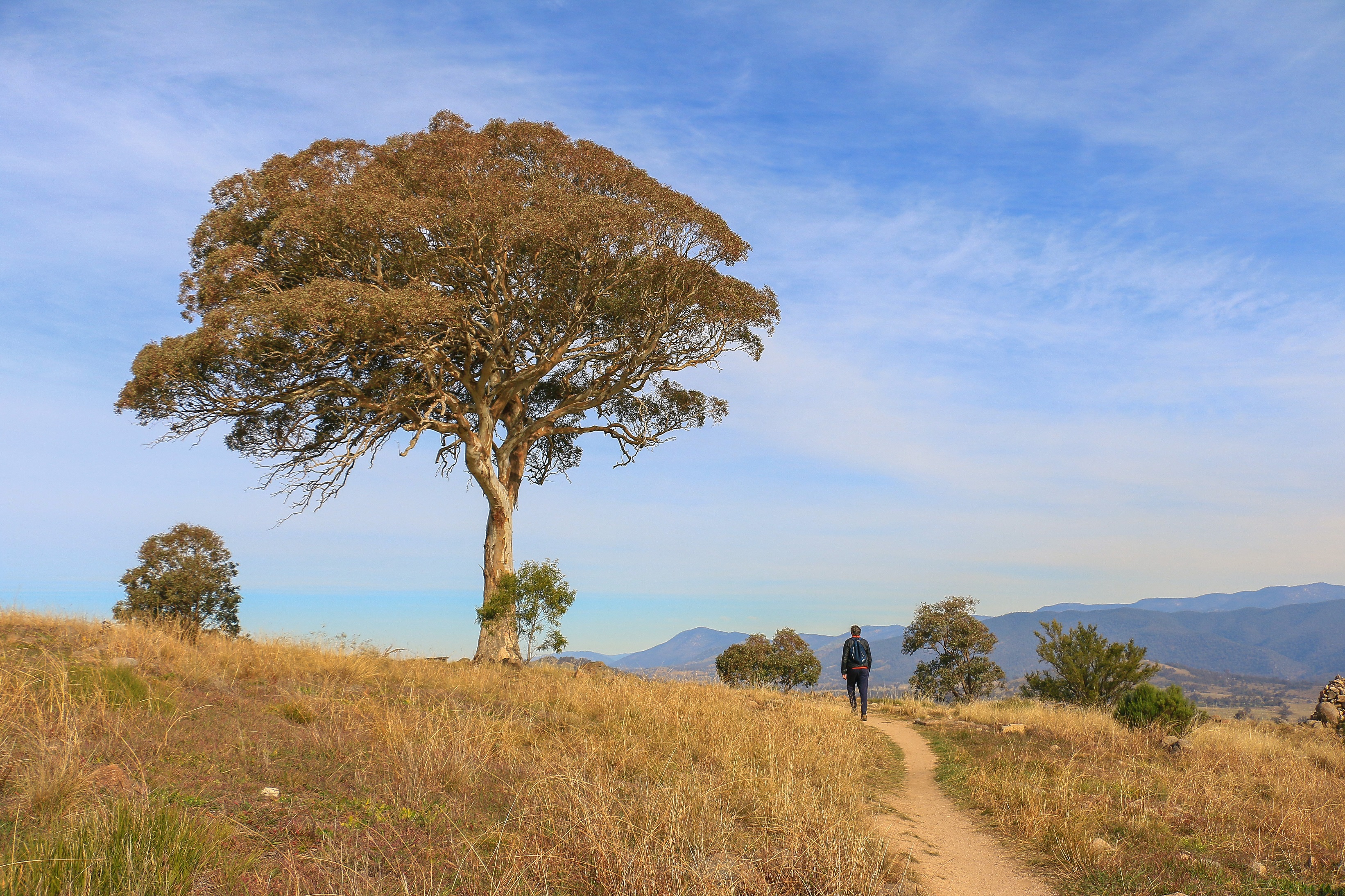
This view fades away for now as the Centenary Trail cuts back to the city side of the ridge, following a nicely groomed flat trail not so far from the backyard fences. Again, it is a Centenary Trail with cyclists at the forefront and this section would indeed make for a rather fine ride. Espying a trig marker rising steeply to the right, Alex is keen to detour, running out of steam towards the top. A gathering of magpies perk up at our arrival, sussing out various potential options to poke out eyes and steal food.
Further views come and go as the trail meanders. At one point it transitions into something a little narrower through a clutch of trees to deliver a panoramic vista again. This one has an information board pointing out various summits protruding from the Brindabella Range. At nearly 1,900 metres, Mount Gingera is capped by ice and snow. Closer grassland hills interspersed with horse paddocks and farmland rise up between here and Kambah Pool, where we think we can see cars parked at our end point. Getting from A to B in a straight line looks infinitely appealing, but the backyards of Kambah await.

The trail leaves Cooleman Ridge at the foot of Mount Arawang which is – unsurprisingly – left to its own devices. Spilling out alongside Namatjira Drive, the trail has officially entered the Tuggeranong district. Following footsteps in Woden, South Canberra, North Canberra, Gungahlin, Belconnen and Weston Creek, this is the final one. What does this southernmost suburban outreach of Canberra have to offer?
The first highlights are remarkably similar to elsewhere as we meander close to a series of roads and alongside a ribbon of back fences in Kambah. Mostly these fences are high and robust, shielding nosey eyes and drifting minds. Gaps hint at homely gardens and family gatherings, vegetable patches and DIY sheds. Mechanical detritus may spill from a garage, salvaged from a 1998 Lancer. Firewood stacks are ready to feed the coming chill as the afternoon drifts toward sunset, and we head west into that milky sun and the high voltage power lines.
Between the road and the backyards, long yellow grass flourishes and occasional small gums form into an attractive copse. This continues all the way along Kambah Pool Road, representing what I think would be a summertime haven for snakes. Today there are just hackers, the odd cyclist, random picnickers, a wombat, and many hens for company.
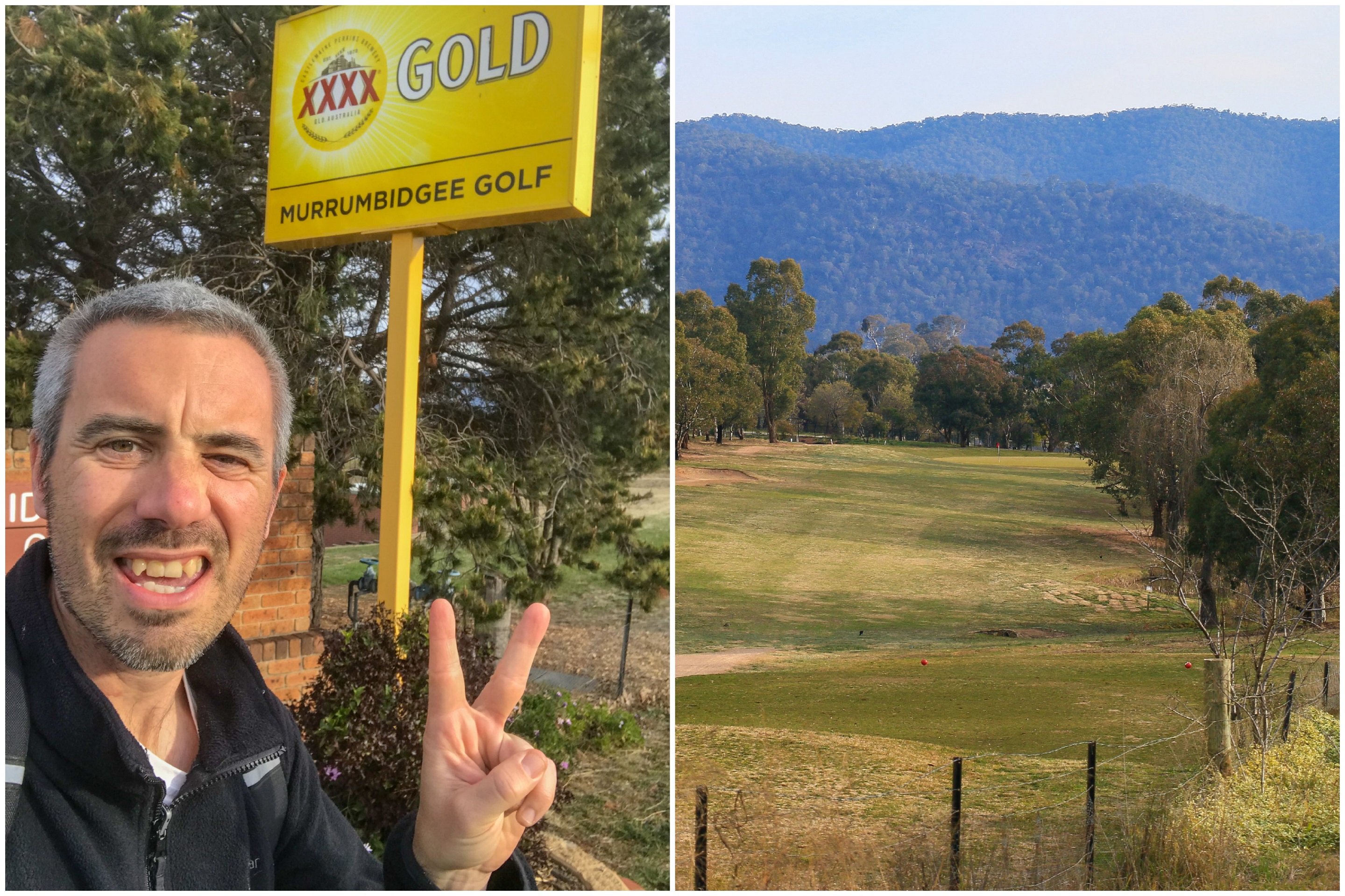
We follow Murrumbidgee Country Club on the left, luring people in to lose their balls and swill a jug of insipid XXXX. The course is fairly quiet at this time of day, an empty fairway leading the eye towards the sheer slopes of the Bullen Range. Houses and sturdy fences have dispersed now, and the going is gently downhill, growing ever more pleasing as the countryside again opens up. Beside one long patch of grass I spy what is either a large rabbit or a small wombat taking sanctuary from sliced drives off the 3rd tee. To my surprise it is a wombat, a first on this Centenary Trail journey.
Getting closer to the river this does look very much like wombat country. But they have to share it with hundreds of hens, roaming free from their huts in fields to the south. Most are clustered near the huts waiting for night to fall, but a few venture closer to the fence and the trail. Their produce sits in a fridge at the end of a driveway and maybe on the next leg I will need an egg or twelve, some poultry for my pantry.
From fences to farms, the city to the rural, a river awaits. It never takes a million miles to be a million miles away.
the numbers
Trail Section: Cooleman Ridge North – Kambah Pool
Trail length walked: 11.3km
Total length walked: 11.8km
Total steps: 15,000
Altitude gain: 120m
Sunday August 2: Coursing
Some days you really begin to doubt. Awakening to a dreary grey fog through windows coated in condensation you wonder why you even bothered. Getting out of bed takes a concerted effort and to soften the blow you wear cosy clothes and make a big cup of tea. You turn the heating up another notch to blast out the cold and – as the fan kicks in an extra gear – to blast out the sound of a prevaricating politician on Insiders. By ten, you mull over putting on some more acceptable garb to go and buy a coffee. But it is still dreadful outside. Maybe 10:30. 11. 11:30. The sky is possibly a lighter shade of white, the visibility maybe an extra fifty metres.
And then it happens. A brief infiltration of half a watery sun. A small splodge of milky blue sky above. A shaft of sunlight on the lower slopes of a nearby hill, its top still coated in a marshmallow of cloud. A parting of the skies, banks of fog rolling north and south to hover a while longer over lakes and nestle within river valleys. By 12:30 the reality that was the morning seems wholly incongruent under a warming blue sky.
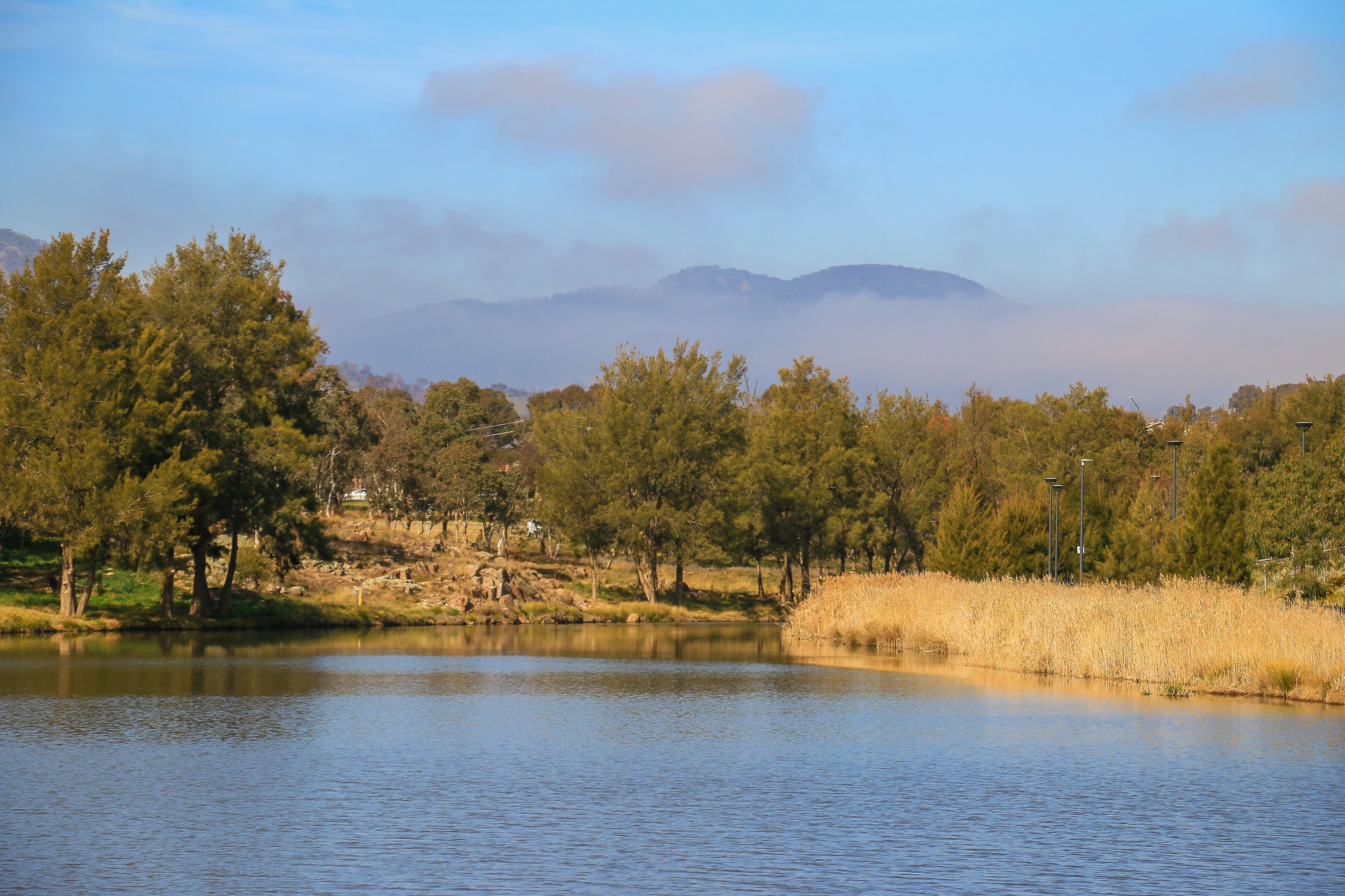
Which was a good job, given I was meeting Alex at 12:30 beside the shores of a sunny Lake Tuggeranong. Being entirely in charge of this endeavour I had decided to make the finish point of today’s walk Two Before Ten, a café situated at the southern end of the lake. While this would add an extra kilometre or two, I figured it was an extra kilometre or two worth paying for a tasty lunch and good coffee. I hadn’t had one yet today after all.
The other dining options upon Lake Tuggeranong are McDonalds and KFC, which seem to better encapsulate the traditional essence of this part of the world. Two Before Ten is a relative, but very welcome, upstart. Things are changing everywhere and down here townhouses and apartments are also springing up in between Bunnings and the local storm drain system. Gentrification would be overgenerous, but I have grown to appreciate this part of town and a big part of that comes with a good coffee spot.
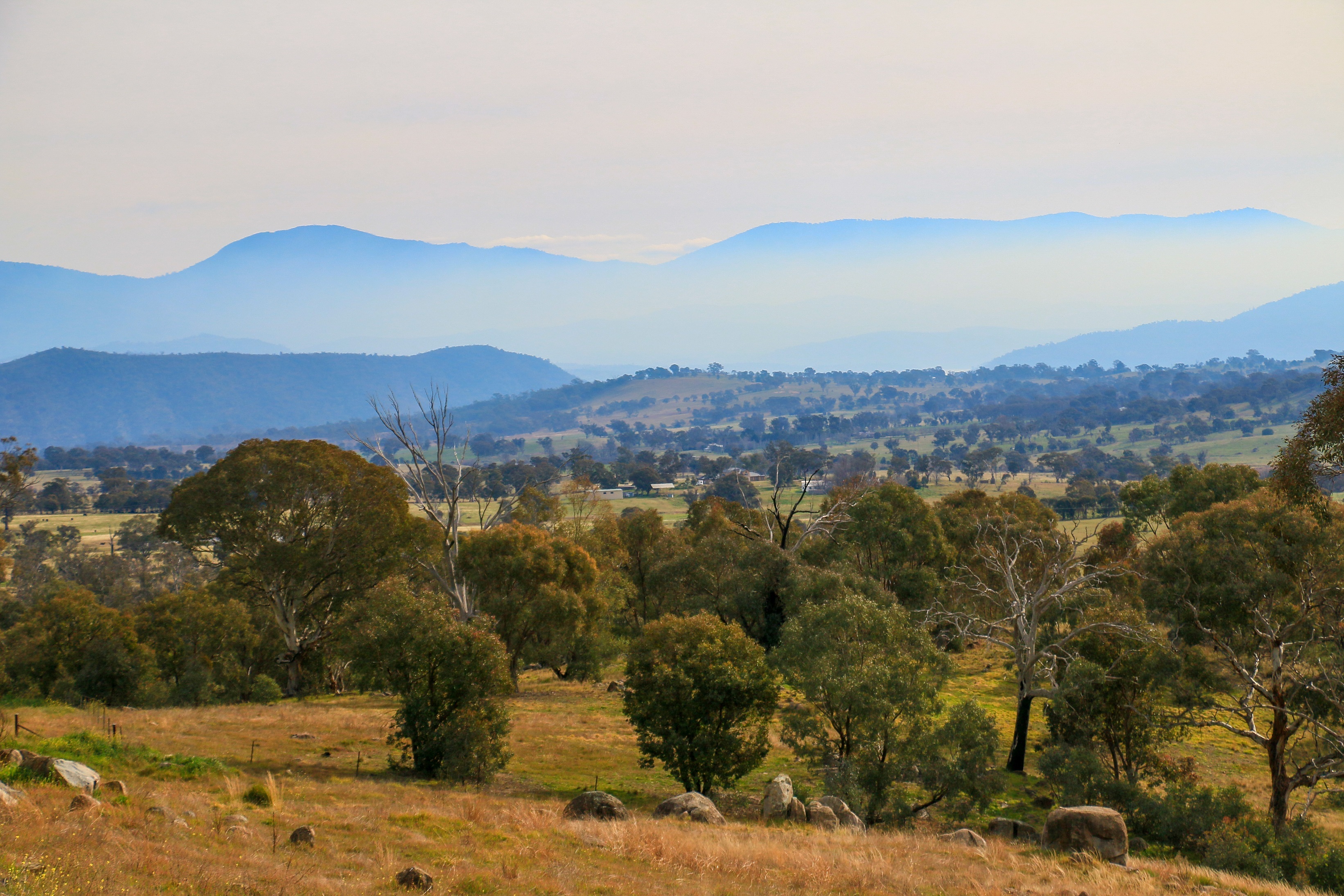
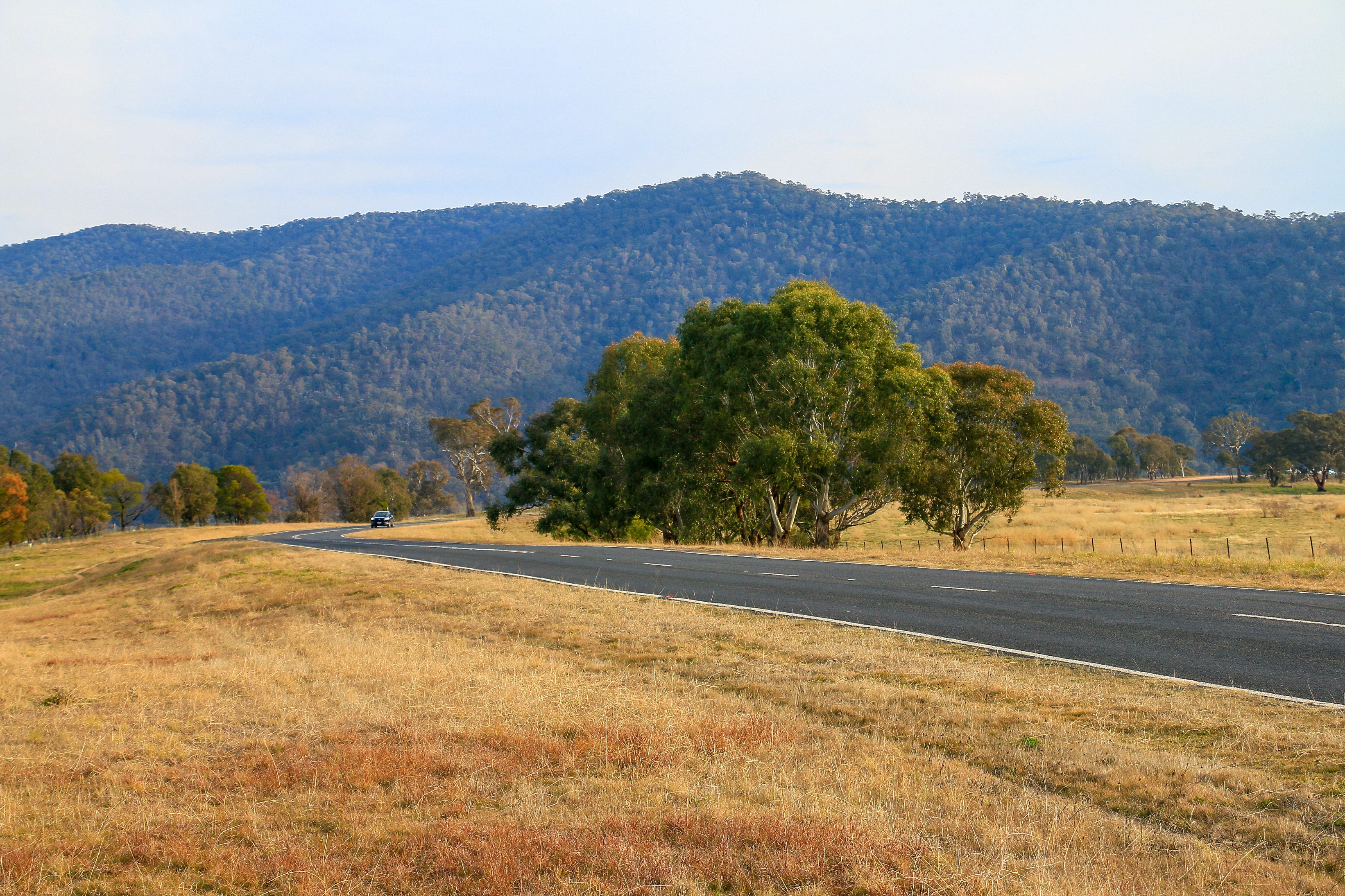
One of the perks of Tuggeranong is the sense you get of being closer to the mountains. Even though it is barely twenty kilometres from the centre of Canberra, you feel very much at their feet. Indeed, just down the hill from Tuggeranong Town Centre, to the west, the Murrumbidgee River marks a low point, sitting in its valley. Beyond, hills and open plateaus roll their way towards the high points of the Brindabellas.
The Murrumbidgee was – for the most part – to be our guide today, stretching from Kambah Pool back towards Tuggers. Kambah Pool sits in a genuinely lovely spot, seemingly a million miles from anywhere. Tucked below an impressive forested slope rising sharply on its western bank, the river here offers a summer recreation experience in which you can either wallow in brown water, surf the rapids or disappear somewhere a bit further downriver to bathe au naturel. Unlikely today, but you never can tell when it comes to the fanatical quest for nakedness.
I think you’d have to be fairly desperate to a) swim in a river where you cannot see where the snakes are hiding and b) do so without any protection. I have accomplished one of those things, but only once in my first ever Canberra summer. Coaxed by Australians who were accustomed to bathing in inland waterways and propelled by another thirty-degree plus day, I took the plunge. I remember it not being particularly deep, the bottom a gritty, slightly slimy floor. The smallest unexpected object causing a heart flutter, I didn’t remain in the river for long. I was glad of the day Alex came to possess a swimming pool.
The Centenary Trail runs slightly elevated above the river from Kambah Pool and at times the Murrumbidgee seems to disappear altogether. Thickets of eucalyptus and clusters of grevillea obscure the view while the track frequently cuts back inland to cross the gullies feeding down to the water. The turns away from the river present a certain countryside charm, a rolling and pleasant landscape possibly hiding more of those free range hens.
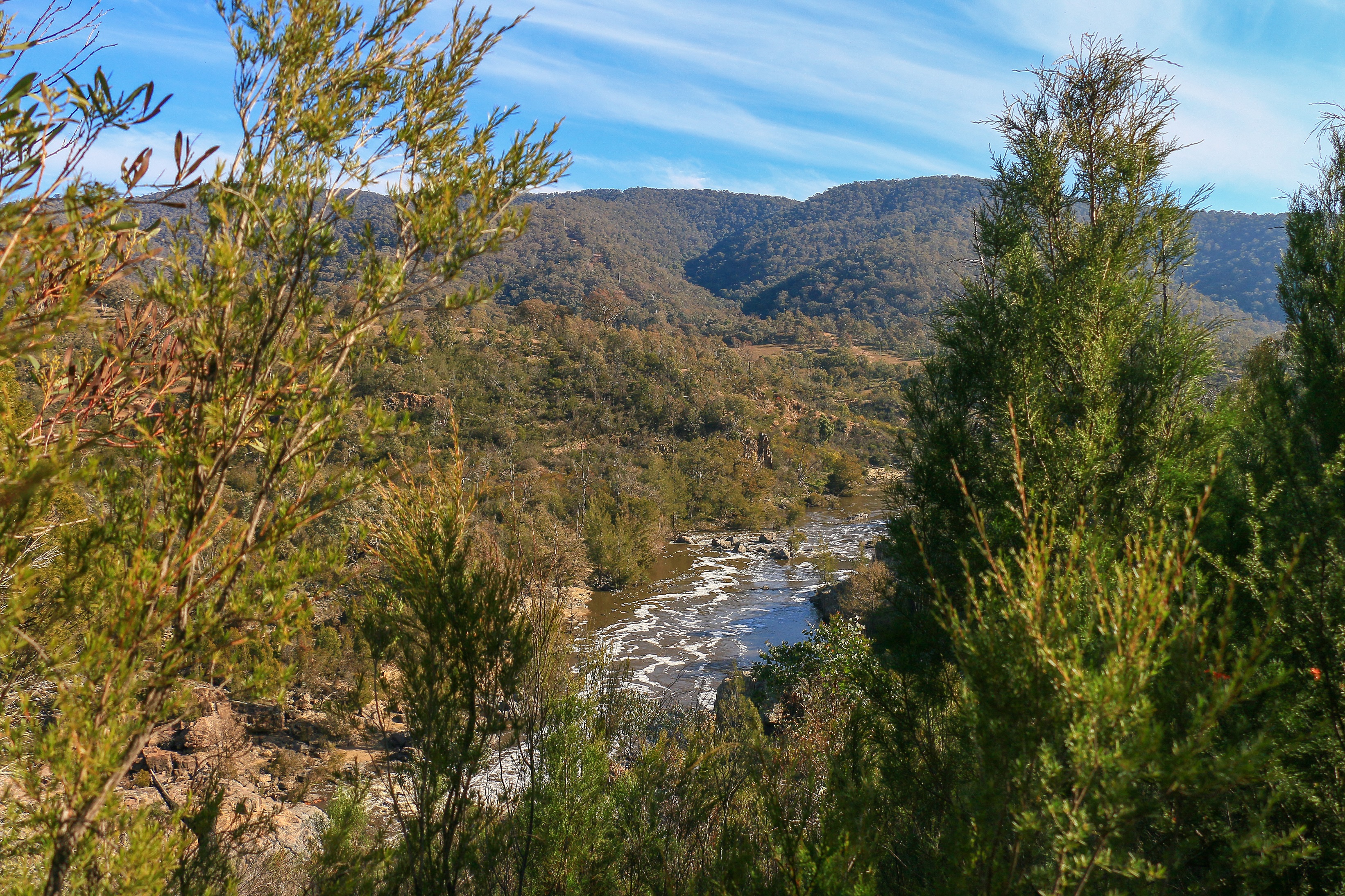
The sound of the river also ebbs and flows in tandem with its becalmed stretches and more vigorous escapades. The intensity rises again as we near Red Rocks Gorge Lookout, where a small platform offers a fine outlook over the water, charging purposefully with recent rains through a deep channel and sweeping ever onwards toward the Murray. This water will eventually, hopefully, enter the ocean near Goolwa in South Australia, around fifty kilometres south of Adelaide. In total, the Murrumbidgee flows nearly 1,500 kilometres and drops 1,500 metres in the process.

The Centenary Trail is miniscule by comparison, but it continues its progress high above the river with a steep drop down to the right. The sound of water and the appearance of pine trees on the slope evoke a North American mood, perhaps somewhere in Northern California where panning for gold in a deep ravine might just pay for your healthcare if you strike it lucky. There are no roads, there are no fences, the trail here even feels more suited to walking than cycling. Perhaps we have reached its golden zenith.
A little further along, after another switchback through a cheery grassy glade, an unofficial track of mud leads steeply down to the water. This – along with the Centenary Trail itself – was my big discovery back in April, when it delivered me to the impressive wall of Red Rocks Gorge. A place back then for socially distanced sandwiches and a shared sense of uncertainty before it all became so wearisome. A realisation that there were still some wonders, still some discoveries that I could make so close to home.

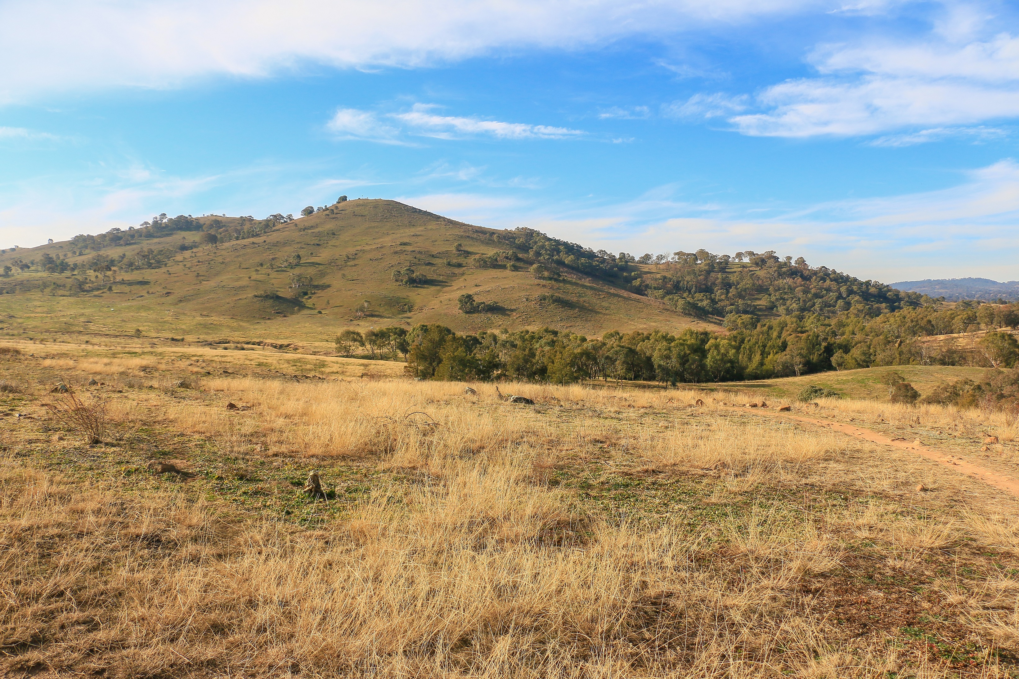
And it is true – I feel like I have discovered so much in the last three months courtesy of this trail. From Red Rocks Gorge, a new stretch of Australian Capital Territory now awaited my feet, at least for a few kilometres. This delivered more open countryside, with a swathe of golden grassland running from the rounded humps of Urambi Hills in the east down toward the river. Across the water, the Bullen Range begins to blend with the higher slopes of Tidbinbilla and Namadgi, more plains and uplands sitting in between. A broadening of the Murrumbidgee glimmers south and, beyond that, the countryside abruptly comes to a terminus at Tuggeranong Town Centre.

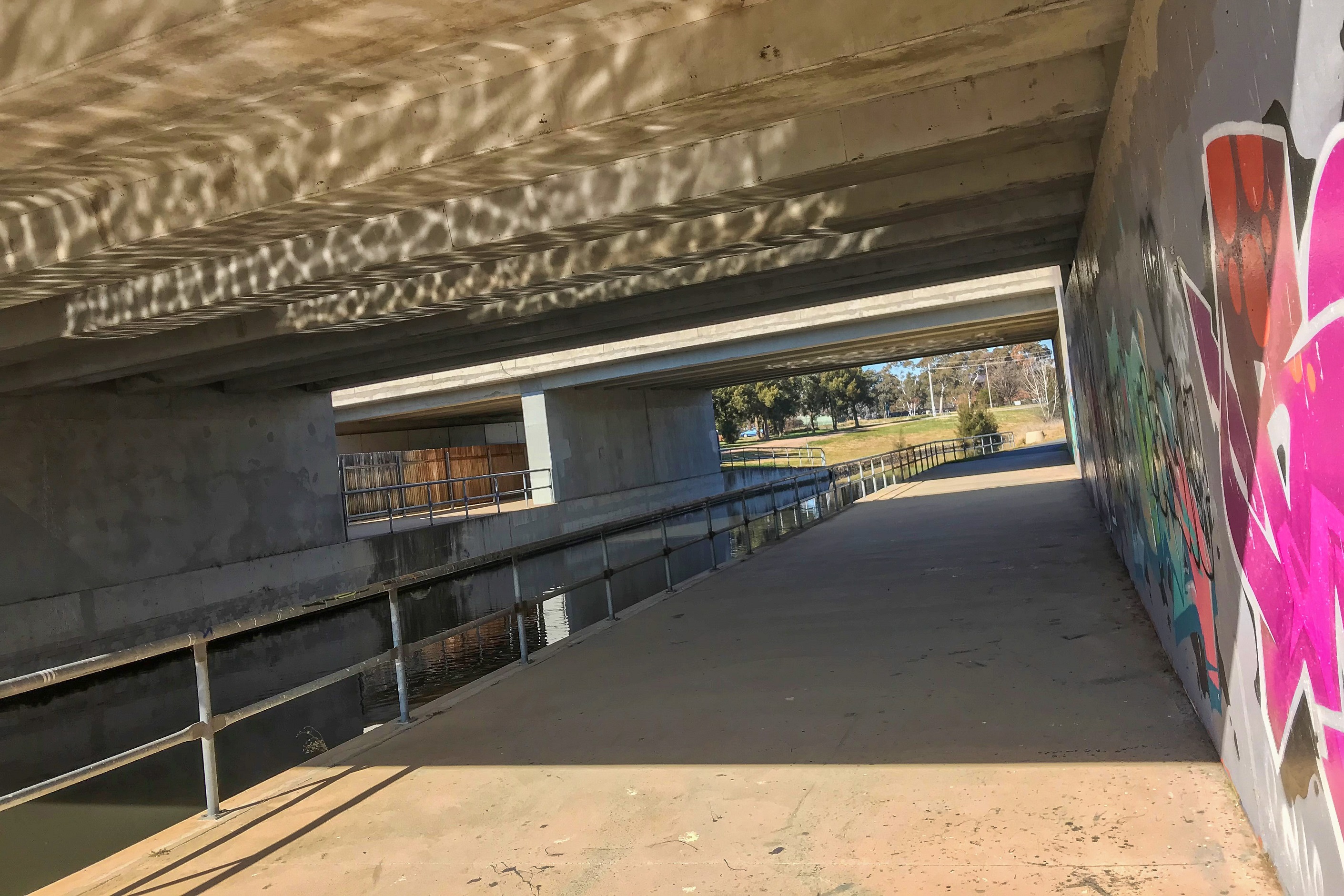
The reassuring sight of the urban suggests the walk is nearly done, but that fails to take into account the circuitous navigation of a watercourse flowing into the Murrumbidgee. This emanates from Lake Tuggeranong itself, something that becomes clearer with a slight whiff in the air. If it wasn’t for this aroma you could picture a rather lovely spot for a picnic beside the running water, shaded by the pines.
While the trail may take an elongated route here it is never difficult to follow thanks to those trusty signs. In fact it appears as though they had an excess of signs when marking out this stretch of the walk. I suspect contractors tasked with completing a prescribed number of signs to fulfil the daily quota who happened to be here on a Friday afternoon. With the sights and sounds of The Vikings Club around the corner, anything to get an early mark.
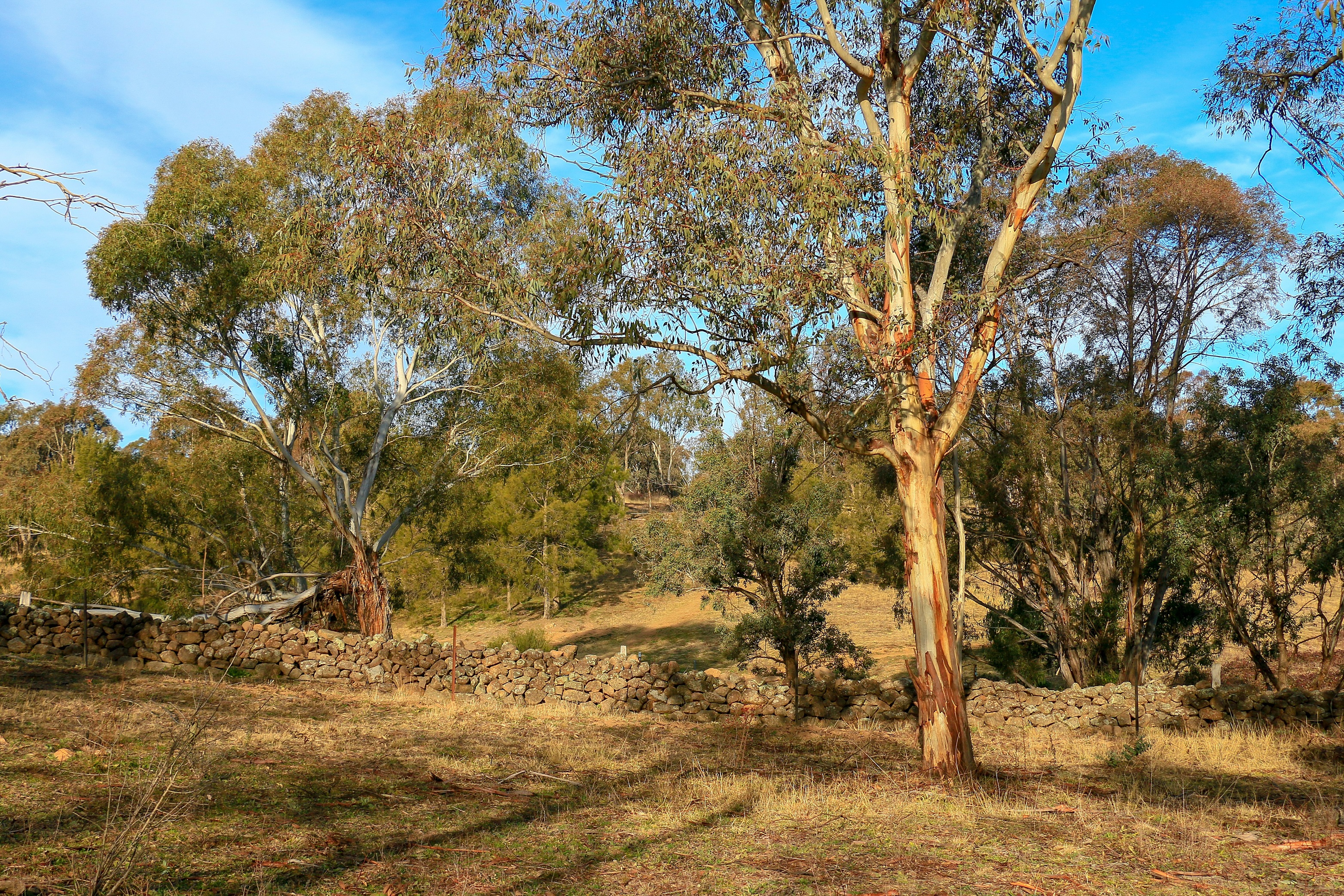
They wouldn’t have been the first to labour down here, the trail crossing Tuggeranong Creek over a small wooden bridge and meeting up with a dry stone wall. The wall stretches up from the river to busy Athlon Drive, some 800 metres or so in length. It was built around the 1870s as a boundary between the sprawling Tuggranong and Yarralumla estates to help stop cattle wandering quite so aimlessly. It may have worked for cows but had no chance against the rabbits. Nowadays it is a charming adornment to the landscape that heightens those pastoral feels so close to town.
The charm is, however, about to abruptly evaporate. From the western edge of the wall, a spring-like idyll of bounteous flowering wattle and sunny long grass tumbles down to a wide, glassy meander in the river. It is from here that we farewell the Murrumbidgee and head up towards the town centre. First the noise of cars on the road prepare; one or two revving exuberantly and singing out to the world in the joyous melody of modified exhaust. Next, power lines slice through the bush to meet up with the bitumen. There are traffic lights and cycle lanes and apartments and bland two-storey temples to public service. The dam wall of Lake Tuggeranong gathers its ooze.

Meeting up with the built environment again, the Centenary Trail could join the shoreline path following Lake Tuggeranong, offering pleasant parkland ambience and sparkling end-of-day reflections. But, of course, it wants to show you the heart of Tuggeranong Town Centre. The bus interchange. Sad-looking ground floor retail spaces to let. The entry to South Point mall. An ingrowing toenail clinic next to Subway. And, of course, McDonalds and KFC.

The last time that two big guns of deep fried takeaway infiltrated the Centenary Trail was at Gold Creek. Between these two points, almost the whole of the city of Canberra stretches. And now I find myself at the other end. I have crossed Canberra from north to south without really feeling like I have gone through a city. Instead, always on the periphery in magnificent reserves or sneaking through hidden arteries between back fences, along storm drains, in surprising bush bordering a main road. And as I stand at the bridge to cross the lake east, I expect I will see more of the same until the very end. Unless it stays foggy.
the numbers
Trail Section: Kambah Pool – Lake Tuggeranong
Trail length walked: 9.5km
Total length walked: 10.5km
Total steps: 14,000
Altitude gain: 160m
