Route: The Main Range Loop
Approximate distance: 22km
Start / Finish: Charlotte Pass
Highlights: Open views and a cluster of alpine tarns traversing the summit of Australia
Conjure up an image of Australia and it probably includes a beach or perhaps an arid, red heart. It is unlikely to encompass mountains, especially of jagged peaks smothered with snow. Probably the most visited mountains in Australia – the Blue Mountains – aren’t mountains at all, but a series of sandstone plateaus carved out by water, forming immense gorges and deep valleys many metres below. They are also currently on fire, a furious incursion onto that idyllic picture of Australia in your head.
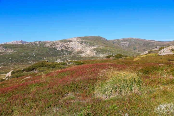
Yet Australia does have the Snowy Mountains, a small enclave of high country hovering over 2,000 metres around the NSW-Victoria border. It is typical of colonial place-naming expertise that these are not especially prominent peaks nor are they bedecked in copious amounts of snow. But I suppose it’s all relative, and the boggy open upland certainly comes as a change.
Covering a huge expanse of the Snowies in NSW, Kosciuszko National Park is one of Australia’s finest. The heart of the park is the Main Range – a section of land containing the highest peaks in which gnarly snow gums disappear altogether. It is a rare habitat hosting several unique species, as well as mainland Australia’s only glacial lakes. And it can be well and truly appreciated on this classic circuit walk.
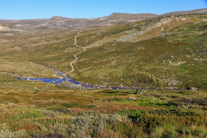
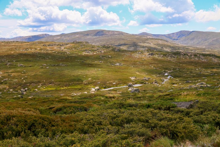
From Charlotte Pass, most of the walk presents itself before you, with views out over the infant Snowy River and the rounded peaks of the Main Range. At some point – either near the beginning of toward the end – you’ll need to cross the river. I can recommend doing it near the start, heading anticlockwise on this loop walk, mainly since this means you’ll avoid a steep climb back to the car park at the end of the walk.
Crossing the Snowy can offer a little adventure, depending on river levels, as there is only a series of stepping stones in place. These are pretty robust and tightly packed together but if all else fails, there is always scope for a very refreshing dip.

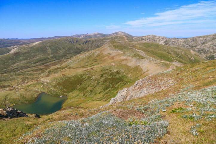
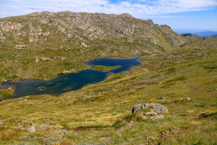
After fording the river, the track climbs steadily upward, opening up views east toward Hedley Tarn. With a few more dips and ascents, the track will come to a junction, with the path to the right leading down to Blue Lake. This is about 5kms into the walk.
The lake is visible near here and you can head on down closer to its shores should you wish – it would probably add on another 45 minutes there and back. It’s arguably the most scenic of the small glacial lakes of the Main Range and, with the right light and wind, the blue certainly can strike a vivid tone close up. A good alternative half-day walk is just to head from Charlotte Pass to Blue Lake, pack a picnic, and then head back.
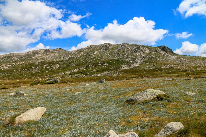
But today the impetus is to push on to the summit of Australia and, appropriately, the climbing kicks in again as the trail heads towards the crest of Carruthers Peak (2,145m). The reward along the way is an impressive reveal of crumpled ranges and ridges to the north and west, a sense of top-of-the-worldness surveying a panorama of infinity.
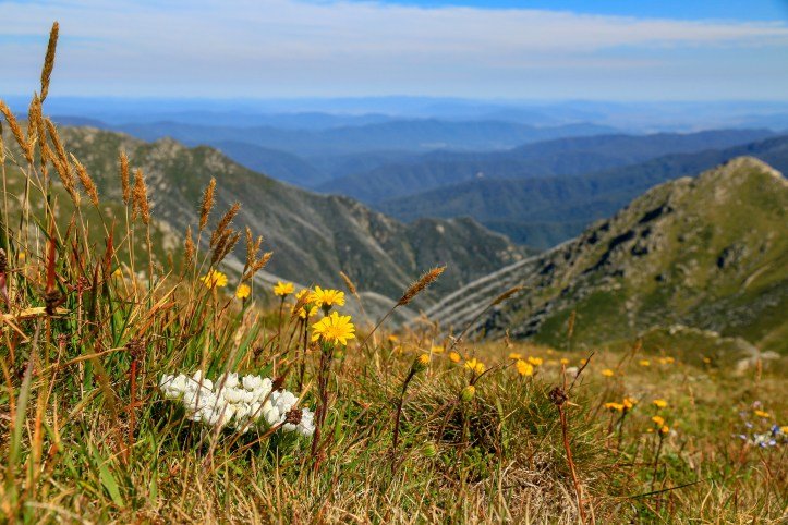
For me, this section of the walk is the most enjoyable as the trail essentially follows an undulating ridgeline all the way to the foot of Mount Kosciuszko. As well as expansive views every which way, the route passes a couple of pretty water features. From up high, Club Lake dazzles and looks every bit the natural swimming pool, while the enclosed surrounds of Albina Lake further along offer an unmatched tranquillity.
It is a tranquillity abruptly broken by the Main Range Trail intersecting the Kosciuszko Summit Walk. It’s fair to say climbing the highest mountain in Australia is hardly a climb, especially for the many walkers commencing from the top of the Thredbo chairlift; this is the quickest and easiest way to get there, attainable for toddlers and tantrums traversing 6km of metal boardwalk and gravel path.
But it’s an effort nonetheless and there is a sense of accomplishment for all at the top. Here, more people than live in nearby villages and towns eating soggy sandwiches at 2,228 metres, the top of a vast landmass.
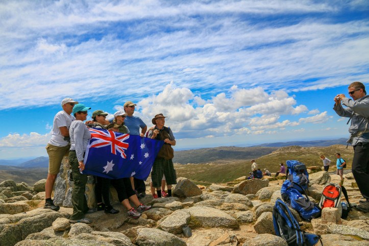
It’s enough to make you dewy-eyed and hum We Still Call Australia Home, despite being immersed in a landscape so atypical of this country. To make things feel more like home, there is a good chance you’ll be joined at the top by thousands of flies. Probably because you have just taken your backpack off which had previously transformed peppery black as numerous beasties found their own home.
Returning down the same way from the summit, with flies in tow, you re-join the Main Range Track (which is also the Summit Walk) and head down towards Rawson Pass. Rawson Pass is unmistakeable, largely due to the presence of a concrete bunker of a toilet block set into the mountain, as if it was some Bond villain’s ablution armoury. There’s also a junction here, south towards Thredbo (where most people disappear) or east to meander back to Charlotte Pass.
And it is mostly a meander, passing Seamans Hut and crossing the Snowy River once more, this time by bridge. Frankly, after what has been, it is all a bit of a traipse; a wide gravel road, a piercing sun, the company of flies and, by now around 18kms in, aching limbs. The views continue over a bleak but beautiful landscape and the Snowy River begins to gather a bit of steam.
It’s a river that will eventually meet some stepping stones, those which you crossed much earlier in the day. But you’ll bypass them this time around, comforted by the fact that the steep climb leading from them is superfluous, the route instead pretty flat as it nears Charlotte Pass. They might not be the most mountainous mountains or the snowiest, but they are unique in Australia and uniquely Australian. With a few climbs thrown in as well.
Extra Steps
- The quickest and easiest way to reach the summit of Mount Kosciuszko is from the top of the Thredbo chairlift (fee applies). From there it’s a reasonably simple and well-marked route, offering some exemplary upland landscapes, including the pretty Lake Cootapatamba. Just ensure you check times for the last chairlift down.
- For a shorter but equally enjoyable outing, a return walk to Blue Lake offers plenty of highlights, including the Snowy River crossing and good views of the Main Range. For a little extra something, it’s worth pushing on a kilometre or so uphill from the Blue Lake walk junction to get those endless views of ridges and ranges, with Mount Sentinel standing guard in the foreground.
- Between Jindabyne and Charlotte Pass, several other shorter walks offer opportunities from the main road, should you want to add in even more kilometres to your day. Personally, I reckon it’s better to head back to Jindabyne for a cold beer!
Links
Kosciuszko National Park: https://www.nationalparks.nsw.gov.au/visit-a-park/parks/kosciuszko-national-park
Main Range Walk: https://www.nationalparks.nsw.gov.au/things-to-do/walking-tracks/main-range-walking-track
Thredbo Chairlift: https://www.thredbo.com.au/activities/summer-scenic-chairlift/?gclid=EAIaIQobChMI4dXFpLjA5gIVwRErCh3j8wIbEAAYASAAEgLquvD_BwE
Thredbo-Perisher area walks map: https://www.nationalparks.nsw.gov.au/-/media/visitor/files/pdf/brochures/kosciuszko-national-park/thredbo-perisher-area-walks.pdf
Some info about the local flora and fauna: https://www.nationalparks.nsw.gov.au/things-to-do/walking-tracks/main-range-walking-track/learn-more
