Route: Pyg Track to summit, return via Miners Track
Approximate distance: 12km
Start / Finish: Pen-y-Pass car park
Highlights: Glorious upland walking, glacial tarns, and phenomenal views when the sun shines
On paper, the mountains of Britain are piffling affairs. The highest, Ben Nevis in Scotland, reaches a mere 1,345 metres in altitude; there are hills on the outskirts of Canberra bigger than that. Yet perhaps it is the very condensed nature of Britain, the variety of landscapes in close proximity to one another, that make its hills appear much more mountain-like. That, and the frequent weather, pummelling the northern and western extremities into bleak, wind and ice-sculpted terrain.
Outside of Scotland, the highest peak is Mount Snowdon in Wales, topping out at 1,085 metres. Known in the local language as Yr Wyddfa, it’s apparently the busiest mountain in the United Kingdom. Sometimes it can feel that way too, but with various routes to the top and wild, expansive surrounds, solace and solitude are never too far away.
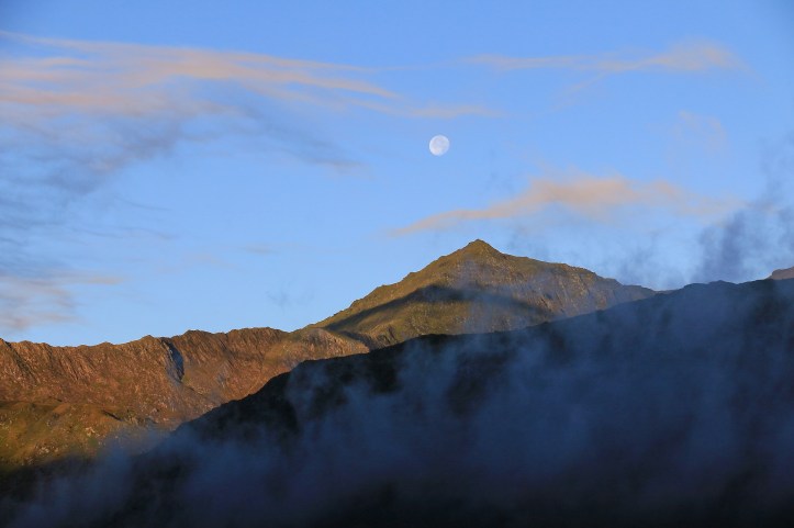
Before 2018 I had never been to this corner of the world and was excited about arising on my last day in North Wales to the prospect of sunshine. Around seven in the morning at the end of September it remained an uncertain prospect, lingering in my mind like the mist and low cloud that still covered the tops of hills and drifted into the green valleys. But it was my last day and thus my last opportunity for Snowdon, so I drove towards Pen-y-Pass on the eastern side of the peak to make a further assessment. And here the metaphorical and literal shroud began to lift, in a drama of rising plumes of cloud and the laser-like penetration of the low sun on the highest crags. Walking up to Snowdon quickly became a no-brainer.
The early start was worthwhile in many other respects. I was able to park at Pen-y-Pass and while the charges may seem exorbitant this is appeased by the absence of a fee to enter Snowdonia National Park and the prospect of being able to return to the comforts of your own car, rather than a shuttle bus, at the end. In order to get away early I had also skipped breakfast and so had to make do with a pack of Welsh Cakes. No tough sacrifice. Fuel for a truly fantastic walk.
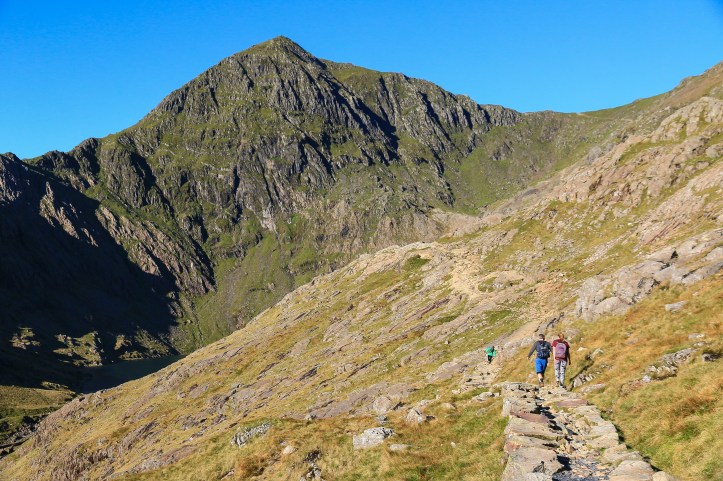
From the car park I set out upon the Pyg Track, which is all well-graded and signposted and – naturally – reasonably well-frequented by fellow walkers. The initial stages took me up in a series of gentle slopes and then more arduous steps to climb high above the Llanberis Pass, cars becoming increasingly miniscule on the curving road leading west. To the north, the expansive uplands of the Glyderau Range shimmer gold in the early morning sunshine. While only a little under the height of Snowdon, the hills here seem gentler, at least from this aspect. Indeed, the highest point of this range – Glyder Fawr – translates as Big Lump, which seems about right.
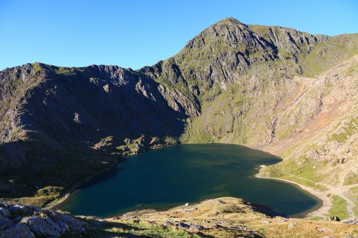
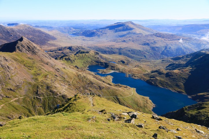
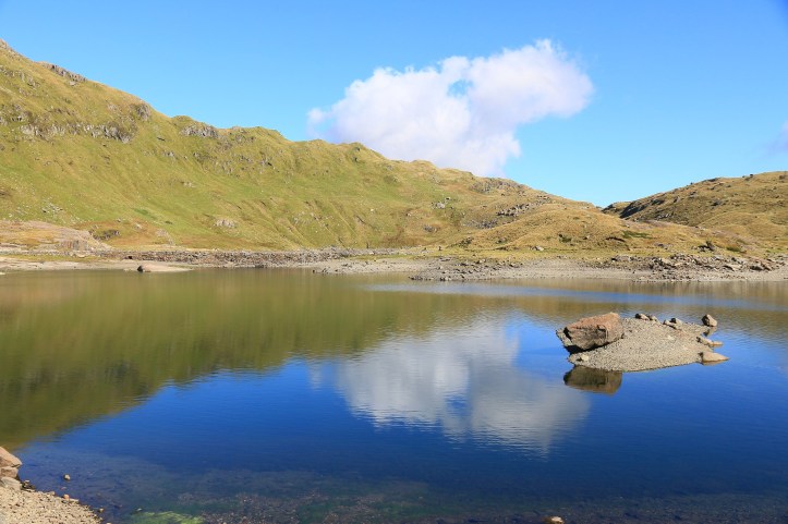
After a couple of kilometres or so, the track crosses something of a pass to enter the glacial valleys of the Snowdon massif itself. Today, the wind suddenly strikes up, enhancing the drama of the reveal. High above the deep blue expanse of Llyn Llydaw the views are striking, with the sheer ridges tumbling from Snowdon presenting this as every bit a mountain. The walking too gets a touch easier, following an elevated walkway for several kilometres to pass above the beautiful cirque of Glaslyn.
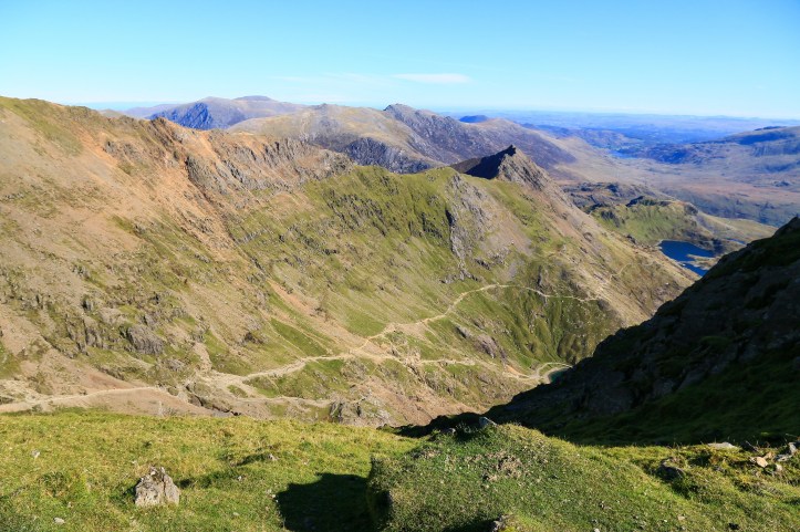
At this stage in the morning, the track remains fairly quiet and it seems inevitable that you will cross paths with the same clusters of walkers again and again. Stop for a photo and they pass, they stop for a breather, you pass. Stop for a Welsh Cake, they pass again, they stop to admire the sheep eking out sustenance on a cliff, you pass. A certain camaraderie begins to form over the shared experience, particularly as the most challenging part of the walk begins to bite. Rest stops become more frequent encountering the zigzags, the path sometimes lacking clarity as boulders intervene. It is never too challenging, but offers enough to provide a satisfying challenge.
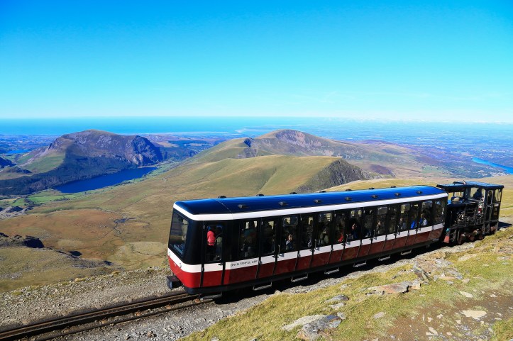
It is a satisfaction that is inflated at the top of the zigzags, when the views open out to the west and down to the coastline of North Wales. For here you meet other tracks making their final way up to the summit and can look on in disdain at the many people doing it the easy way. The steam train to the top looks like it will be a very jolly experience and in my mind I can see Michael Portillo on there now, all pink blazer and lime green trousers. But I’ve earned that smug self-righteousness that comes with walking, which is possibly conveyed in the wave I reciprocate to passengers as they cruise on by.
After something like two and a half hours from setting out I make the summit. It’s marked by a windswept cairn reached by a few further steps that seem designed to offer the adrenaline of vertigo. Coinciding with rail arrivals it is alternately bedecked with the masses or relatively empty. You give a knowing nod, perhaps a quiet well done to your walking comrades. You soak up the views, staggering in all directions. And then grab a bad coffee and use the free Wi-Fi in the nearby station.
At some point you need to contemplate getting back. While the prospect of gravity being on your side is encouraging, your knees and ankles are wary of the shock of descent. It is back onto the zigzags and now you can feel even more smug, as streams of walkers suffer on the climb. A few look sweaty, forlorn, on the precipice of a heart attack and you remember that feeling. That feeling that maybe the train wouldn’t be such a bad idea after all. But persevere and it is worth every slow, grinding step. As long as those fluffy white clouds beginning to build stay away.
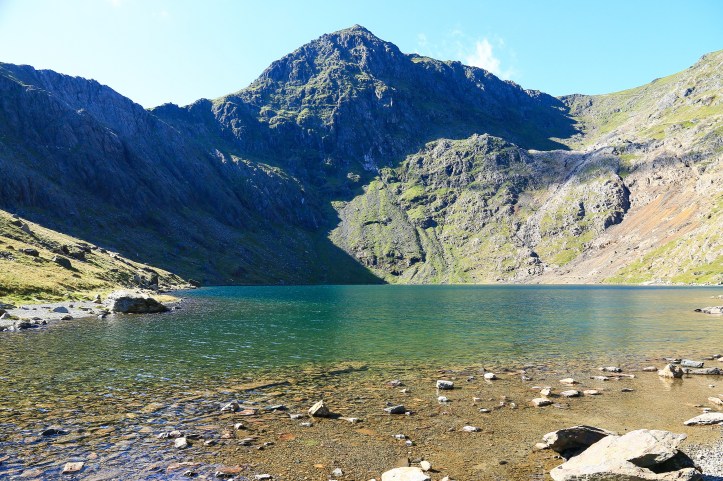
The procession of walkers now is in stark contrast to earlier in the day, an amalgamation of people coming from both the Pyg and Miners Tracks. Soon after the zigzags I divert onto the Miners Track, which heads down to the tranquil shores of Glaslyn. This is prime lunch-eating terrain, a blissful spot in the sun to eat a lardy pork pie and justify it with the fact that you had just been up there, on your own steam.
Leaving Glaslyn, the Miners Track proves pretty easy going, heading gently downhill on a wide, well-made path to Llyn Llydaw. Up above on your left you can occasionally spot people on the Pyg Track, soaking up the reveal that you revelled in earlier. Beside the lake a few ruined buildings appear, mining relics to entertain bored primary school students on their field trips. And the path meanders in a seeming never-ending circle to the other side.
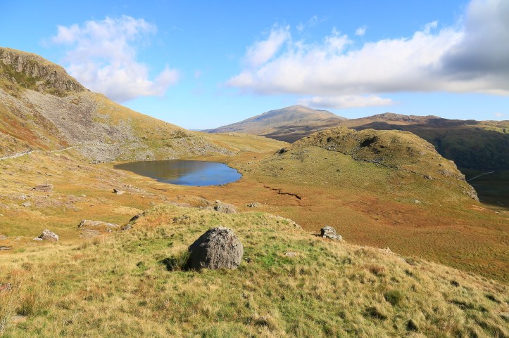
It was at this stage that I was finding myself more than willing to get back to the car park. Descents and returns can seem to drag, I think mainly because you are coming down from the highlights of summitting or something. You have achieved what you set out to achieve, you have seen what you set out to see, and eaten everything you had to eat. Thoughts turn to civilisation and potential rewards in nearby Llanberis. One final turn, one final loop around Llyn Teyrn, and one final appreciation of this rugged, sun-bathed scenery before reaching the car.
And now, finishing the walk all that is left is to pack up and head off in the car to Llanberis for an ice cream. For you have climbed, yes, climbed a mountain.
Extra Steps
- Snowdonia is more than Mount Snowdon and there are many other walks within the national park if you had enough time to check them all out! I found a scenic walk that was relatively shorter and easier from the Ogwen Valley up to and around Llyn Idwal. Offering a glacial lake and sheer sided cliffs, optional tracks continue steeply up from the end of the lake onto the high peaks of the Glyderau should you wish to venture further.
- Pen-y-pass has a hostel and reasonably sized car park (costing at the time of my visit GBP10 for the full day, which is the only time option). There are also toilets and ranger information. If the car park is full, a shuttle bus can be taken in summer (the Snowdon Sherpa) from a number of nearby villages and towns.
- For those more intrepid, an alternative diversion from the Pyg Track towards the top (which I saw some people taking) can be made up to the rocky ridgeline of Crib Goch. This path climbs steeply up just prior to the first pass where you get a view of Llyn Llydaw and comes out near the top of the zigzags. It could offer an alternative route back and I’m sure some sublime views, though I can’t vouch for its quality or level of fitness required. It looks tough!
- Llanberis is the nearest town of any decent size and is the starting point of the Snowdon Mountain Railway. Thankfully I found some good home-made ice cream at Georgio’s.
- There is some scenic driving through and around Snowdonia, so staying a little further out is no big deal – the national park is quite compact. I stayed in an Airbnb in the small village of Penmachno, just out of Betws-y-Coed. This came complete with a useful pack of Welsh Cakes. I was also charmed by the town of Conwy, which is well worth a few hours to explore.
Links
Visit Snowdonia: http://www.visitsnowdonia.info/
Snowdon paths: http://www.visitsnowdonia.info/snowdon_walks_-_6_routes-95.aspx
Snowdonia National Park: http://www.snowdonia.gov.wales/
Snowdon Sherpa: https://www.gwynedd.llyw.cymru/en/Residents/Parking-roads-and-travel/Travel-passes/Snowdon-Sherpa.aspx
Cwm Idwal walk: https://www.nationaltrust.org.uk/carneddau-and-glyderau/trails/cwm-idwal-walk

[…] every single step of this walk here, you can – should you wish – read more about it in this shameless cross-promotion for yet another blog page I have been working on when lulls in work strike me down with boredom. In summary: epic, awesome, […]
LikeLike
[…] climbed Snowdon the day before I wasn’t overly keen on walking far, but my insatiable instinct to seek a […]
LikeLike